Thursday, June 27, 2013

Floaters and Blues!!!

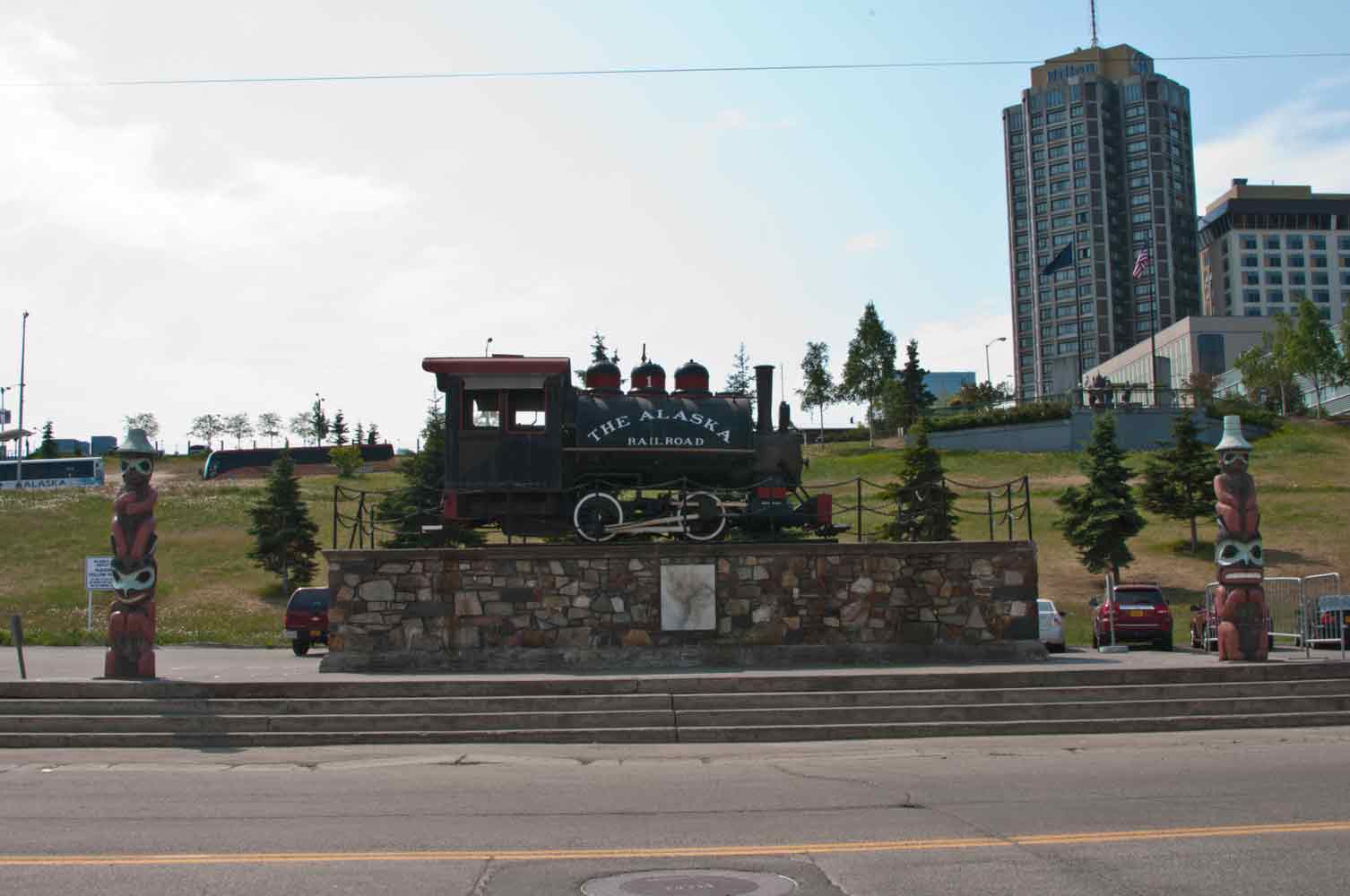
The first stop in Anchorage today was the Alaska Railroad Station and gift store.   We were looking for a few good souvenirs, which ended up being a new AR coffee cup for me, along with a great yellow and blue AR logo rain jacket.  I'll let Dan explain the railroad part, except they have been in business since 1923 and are the only passenger service in Alaska.
Then it was off to the largest float plane landing strip, Lake Hood/Spenard Float Plane Base.  This is one side ... you can see the green berm, then there is another strip on the other side.  Just as we drove up, a nice yellow something or other landed ... but we missed it.  That's okay, we will wait for another one to land, for picture's sake.
At the end of the water runway is a huge pond, surrounded by float planes.  Across the strip was another huge section ... all for planes landing on pontoons, each with it's own little dock and storage building.
Finally ... one is going to take off!!!  Only he just motored to the other end.  Still waiting for one to land.
Another take-off, right over our heads, was Rust Aviation ... a popular tour/guide company here in Anchorage.  Still waiting ... we'd probably STILL be there waiting, but Dan's hamburger craving kicked in and we finally left.  
Back at the ranch (after the burger), we dropped Dan off and Patty and I headed to downtown to see the log cabin Visitors Center, complete with grass roof.  The flowers were spectacular!!  Two quilt shops later, we were headed back home.
So what are the "Blues" you say?  Why OREO'S of course.   I found these at the local Walmart.  I've never seen BLUE Oreos ... Summer Oreos ... Just what I needed!!!  They now live in my freezer for their soon to be short lifetime!!!


Wednesday, June 26, 2013

Valdez to Anchorage AK .. 6-1/2 hrs ...

We left Valdez bright and early this morning ... bright because the sun sets here at 11:30 pm and rises at 4:08 am.  We are heading off to Anchorage.  Gorgeous Thompson Pass was just as pretty on the way out and it was coming in.
There was a little construction in Glennallen where we turned Northwest.  Dan was giving a narrative on our two-way radios about the water truck making it's second pass over the road we had to travel.    Having just washed this monster (and still very sore), I wasn't getting ANY cement on the sides ... so I went 15mph.  I don't care what those 10 cars behind me thought!!!  LOL
The night before, my new neighbors complained about that really narrow road between Anchorage and  Glennallen ... and they certainly hoped we weren't going that way.  Well we were ... with one tire on the yellow line and one on the white, we went pretty slowly for 20 miles or so. 
Here is another construction section.  The road with the GOOD bridge is on the right.  The road with the BAD bridge is on the left ... guess which one WE had to cross.  The LEFT one.  There is one nice thing about Alaska roads though, there aren't very many.  They have Hwy 1, 2, 3 and 4.  That's about it!!
I keep hoping for a nice grizzly or brown bear sighting ... nothing yet.  This guy however, lives at the Whitney museum we visited yesterday.  I just wanted to be sure you saw one ... even if he is stuffed!!
We finally arrived in Palmer, got fuel at $4.10 ($4.05 with a Safeway card), and trucked on off to Anchorage, 35 miles on the only 6 lane freeway in Alaska.  I'm sorry Anchorage ... but I finally found the place I do NOT want to live ... and it's here.  There's too many buildings, too many cars and too many crazy people, like the guy who filled up his truck and promptly lost his keys in our fuel lane ... or the tree guy who was in too much of a hurry to get to the fuel station, running around yelling a lot.

We are parked at Ship Creek RV Park, next to the railroad tracks ... which you know we love!!  Three passed by, but none in the middle of the night.  They have back-in spaces with 30 amp full hookup and GREAT wifi!!  We will be staying here checking out the sites for 2, maybe 3 days.  There's no sleeping in though ... at 6:30 reveille was played loudly ... I think from across the street.  It was hard to tell where it was coming from!!

One thing Anchorage IS good for ... quilt shops!!!


Tuesday, June 25, 2013

The Good and Bad ... Washing My Rig!!

The good .. the rig and car are clean (sort of).  The bad .. I hurt all over!!!  After about 52 days on the road, it was time for a wash.  There is lots of road construction going on while the sun shines.  I don't know what they put in the water up here, but it makes the roads, and therefore the bottom half of my rig, covered with a sandpaper-like product.  You can wet it, wash with a brush, rinse, and it doesn't look like you did anything.  Dan and I started about 9:30 this morning on our cars .. I finished my Liberty and rig about 1:30.  I wore my shortest shorts, hoping some nice guy would come help, but alas there were no offers, except for me to wash a motorcycle.  Sorry dude ....

Anyway, since we are leaving today, Patty and I hit the one and only native crafts store.  I'm trying to get just one nice thing from each major city, as mementos of this trip.  I am so surprised that there is not more available here.  I guess since there are no cruise ships, there are no gift stores.  I picked up this nice basket, with seal and caribou fur, made by a local artist.
While out running around, we stopped by the Maxine and Jesse Whitney Museum at the Community College here.  At one time the largest private collection of native arts and artifacts, it was donated to the Prince William Sound Community College and is maintained by donations.  If you visit here, be sure and check it out.  They have the most amazing collection of native animals also.
While Patty created some great Halibut Chowder, I used up the last of the rhubarb and made a coffee cake for breakfast.   When you're on a roll ... next I gave Cooper a haircut.  It's a good thing he doesn't care what he looks like!!  I forgot to bring the attachment to make sure I didn't go too short.  He looks pretty crazy ... I just tell people he did it himself!!  

We are moving on to Anchorage this morning, stiff and sore as I am, heading off on another adventure!!

Monday, June 24, 2013

A Little Valdez History!!

This area, like many others along the Alaska coast, was formed by glaciers.  The Valdez Glacier has receded to a small patch of white in the "V" of these mountains, forming the small glacial water lake at the bottom.
We spent most of the day at the Valdez Museum learning about the history.  The original natives wore clothing like this.  I hope you already had breakfast, because the parka on the right is made from seal gut, sewed together.  The one of the left is bear gut.  Sounds pretty stinky to me, but I'm pretty sure it was waterproof!!
With the Yukon Gold Rush in full swing, some of the steamship companies began to (falsely) advertise a faster, better, All-American Route to riches, over the Valdez Glacier.  The town of Valdez was soon filled with entrepreneurs selling goods for the trip.  Problem was, it was one of the most difficult ways to go.  
 Local trappers and natives had already set up business here with small log cabins like this one.
Eventually, a road of sorts was built towards the interior, along with 20+ roadhouses as rest stops along the way.  Here's one at the top of the pass.
Eventually the Richardson Highway was built ... pictures show not much more than a rocky trail over the mountains, but a road non-the-less.  This sign hangs in the museum, but if you look close at the top, I think the uppermost board has been either added or exchanged for the original.  Wonder what it said before?
Fishing became big here, with several varieties of Salmon and Halibut.  We hit the fish store and picked up local crab, halibut and canned salmon.  Dan had the crab for dinner and said it was excellent!!
As time went on, the locals set up shop with bars, restaurants and homes.  This entire bar is from the Pinzon.  More on this later.
This was a town of adventurous people, including the women.  Female pilots were pretty much unheard of.  With wooden skis strapped on their small planes, they carried people and freight to the interior, wearing outfits like this one to beat the freezing cold.
When oil became a priority, the Alaska Pipeline was built by people who didn't know it couldn't be done.  The first barrel brought about a big party!!
As the oil flows, it clogs up the pipeline, sort of like your heart pipeline.  This red unit is called a pig.  It goes from one section to another, rooting out the sludge in the line.  They even have "smart" pigs that can check the pipeline itself as it goes, looking for weak spots.  Gee ... so much like heart surgery!!
If you look at this map, the spreading area on the right is the pile of gravel and dirt left by the glacier.  What the original settlers didn't know, was that this was NOT the place to locate a town.  In 1964 when the plates shifted causing the earthquake, it also caused this entire area to liquify, resulting in severe damage to the town.  The resulting tsunami flooded the town for three days but did not "wipe out the town" as most think.  When it came time to rebuild, the City Officials decided they should move the town to the top left of the map ... on bedrock ... to prevent another disaster.  A lottery plan was devised to decide who got which parcel.  The Pinzon back bar ended up being saved and placed in the museum, along with another beautiful bar.  Some people actually moved their houses to the new site, some just built new homes.  Nothing remains of Old Town, as when everyone had moved out everything they wanted to keep, the remaining buildings were torched.  
As we drove from one side of the bay to the other, Patty saw two or three of these guys swimming around.  They are VERY shy, but I was able to get one shot.
Then we discovered the nesting spot for these Kittiwakes.  They are terribly vocal ... all vying for these nests on the edge of the bridge.  
All the nests appeared to be empty except for this one.  With Dan's help (by walking closer to her) she stood up so I could see the egg.
At the end of this road was the current location of the oil plant.  When the earthquake happened, the original tanks caught fire and burned for days, then extended to the second oil plant.  Although oil has brought lots of money to this area, it has also brought lots of heartbreak, including the Valdez oil spill.  They are trying to forget that incident now and go forward.  With all the new regulations and controls in place at this point, I hope that doesn't ever happen again.


Sunday, June 23, 2013

Stuck in the Bergs!!!

Just sit right back and you'll hear a tale,  a tale of a fateful trip.    That started from this tropic port
aboard this tiny ship.  Hmmm Hmmmm    a 3 hour tour .. a 3 hour tour!!!

Well our 5-1/2 to 7 hour tour turned into a 10 hour grueling but fantastic trip, caught in the icebergs of the Columbia Glacier in Valdez.  Here's our little ship, however it's not too tiny.  A steel hulled beauty piloted by Captain Fred, his wife and three college girls working for the summer.
Our first stop in the fairly cold weather was a group of sea otters basking in the bay.  If there are any problems with the oil company (you remember the oil container ship that ran aground in Valdez), these guys won't be around.  Captain Fred says they are a good sign that everything is good in Valdez now.
Cute babies, waving their long tails to stay in the group.
Then someone yelled killer whales ... and off we went in search of them.  What a sight to see.  This male laid on his side, flapped his fins a couple of times, then put on a show for us.  
I've seen this on TV a lot ... it's much more fun in person!!


All 30 of us could have gone home happy at this point, which might have prevented what happened later!!
But there was more.  Quite some distance out, Captain Fred was looking for puffins ... and found lots of puffs in this cave.  When he pointed the bow in towards the hole, I couldn't believe he was going to put us on top of this blow-hole.  Everyone on the bow put their hands against the rock wall to keep us from hitting the sides.  
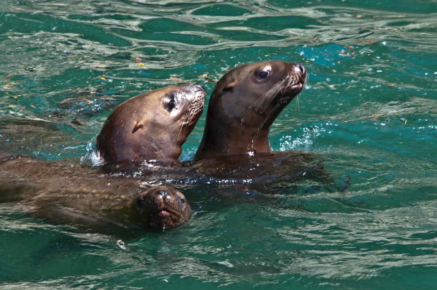
As we backed out, I could smell the next sight to see.  Just to our left were stacks and stacks of sea lions at the water's edge.
A few babies roamed around on the water, but due to the killer whales, they didn't roam very far, except for one guy that got a little too close.  I won't show that picture ... it wasn't pretty and I doubt he will survive.  A good lesson in nature.
Hanging on by her toenails, good spots to bask in the sun are limited by the big bulls pushing everyone off the rocks.
Here's one giving a baby "what for"!!!
As we headed out to the glacier, lots of icebergs started to show up.  Having stood on the bow for the last two hours, it was getting frightfully cold, so we went to the stern to get out of the wind.  It's sunny and gorgeous now!!!
Flying around and squawking, although at quite a distance were the eagles I had been looking for.
Soooooo, check out the ice.  The further out we got, the more I thought "he's certainly NOT going out there" ... and out there we went.
A pair here ... again, VERY far away.  Yes, it really is this beautiful ... the water changes from turquoise to blue to black.  
Around every large iceberg were more babies to see.  This little seal, almost full grown now, took a dive when we got too close.  No, he's not on land ... he in the middle of the icebergs with us!!
And it got worse ... and worse ... and here were two more baby seals to take our minds off the HUGE icebergs we are traveling through ... at 2 miles per hour.
At about 2-1/2 miles from the glacier, we finally couldn't go further and stopped for pictures.  You can see two glaciers in the far distance.  One looks like a road, but the entire thing is ice.  Another comes from behind the brown mountain on the left.  
So here she is ... the Columbia Glacier up close and personal.  The face is around 300 feet high and extends down to over 1300 feet under water.  This is the calving edge, where the ice breaks off and falls into the water, causing what we are floating in.
The crystal blue ice is where calving has recently occurred.  See how high that wall is?  See how high the chunks in the water are??  Yup ... we are in the middle of that!!  Pretty scary!!
It's now 30 some degrees outside with a nice breeze.  I could tell you how cold the water is, but Captain Fred's thermometer only goes down to 30.  It's MUCH colder in the water.  Picture time!!  This crew doesn't even try to gouge you another few dollars.  They take your picture with YOUR camera!!  
Pretty crazy!!!  Now, it's time to go.  It took us 15 minutes to just get turned around without jamming an iceberg in the hull and sinking us.  I'm pretty sure everyone is thinking the same as me.  In fact, I KNOW so, because everyone went inside except Patty, Dan and I.
Here's your iceberg lesson for the day.  The glacier, as it is pushing down the mountain, makes a big moraine in front of it.  That means a big hole with an edge, like a punch bowl.  The biggest calving icebergs to fall off the face, are deeper than the punch bowl, and so as the tide goes out, get grounded on the lip and can't move at all.  The space in the lip that we went through was only twice as wide as the boat, and full of smaller icebergs.  You can imagine, as the tide goes out, so do all the icebergs you see here, effectively blocking your exit.  If that space in the lip gets too jammed up (35-40 deep and 50 feet wide), you're staying for awhile.  
You could actually SEE the water as we went in towards the glacier, but on the way out, it looked like a solid mass.  As we went through the moraine, we had to push a huge iceberg ahead of us, hoping it wouldn't get caught on the bottom.  At only 35-45 feet deep, there was a good chance of that happening.  We continued along sooooo slowly, at barely an idle, pushing icebergs the size of houses off to the side.   I felt like the old explorers who came here in wooden ships, pushing the ice aside until they finally couldn't move any further, as the ice froze up around them.  
Two hours later, we are STILL in the bergs .....
Here's a good example of what's below.  Captain Fred says 10% iceberg above, 90% below.  That's even scarier ... some of the ones we bumped against trying to get through, didn't move AT ALL!!!  They were that big!!
Almost in the clear, we passed a few blue beauties ... this one has tilted to the right ... the straight line used to be the water line.  As we were moving along slowly, we saw a couple turn over.  Spectacular!!!
Free!!!!  We are finally free of the bergs!!!  Three hours behind schedule (my poor baby dogs), but heading back quickly now.  Until we spy some Dahl dolphins.  These guys scream past the boat, hitting the surface with a huge splash, and big WHOOSH as they exhale, gulp another breath and head back down.  They played at the bow of the boat as we cruised along.  WAY too fast for a good photo, but you get the idea!

Heading back to the dock, the huge "end of the pipeline" oil plant here in Valdez is pretty anti-climatic.  It's the Alaska Pipeline that brings oil here, to fill container ships headed for processing plants much further south of the US.  Maybe THAT's why our fuel is so expensive!!!
It's now almost 9:00pm  ... we are all exhausted from the cold as much as the iceberg stress.  It was the most amazing trip I have ever taken .. the crew were wonderful (brownies for $1) and provided lots of reasonably priced food, including Clam Chowder.  Wish I had known, my ham sandwich just didn't do much for me!!  

I don't think anything can top this trip ... today clouds are rolling in and a little rain is expected.  That's okay, nothing can dampen our spirits after getting stuck in the bergs!!!